

Arrival and boarding
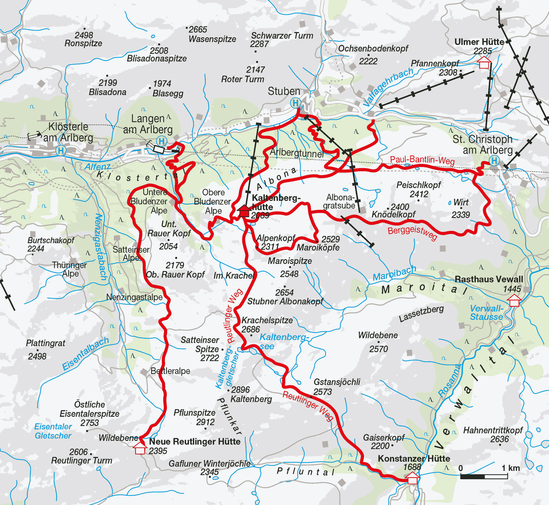
The Kaltenberghütte is located in an exposed spot, from which ideal hikes of all levels of difficulty are possible.
If you, dear mountain lover, want to experience a still intact mountain world, then you are in good hands at the Kaltenberghütte. It is the base for the Verwall circuit and offers a picture-book landscape of a special kind in its surroundings. Lonely and quiet paths, blooming alpine meadows and a glacier hike to the Kaltenberg.
arrival
By trainTo Langen or St. Anton am Arlberg.
Plan your journey by public transport (ÖBB)
By carFrom Lake Constance towards Arlberg/Innsbruck or from Innsbruck/Landeck towards Arlberg/Lake Constance.
boarding options
Talorte:
- Stuben am Arlberg (1407 m) – sufficient parking spaces available
- Langen am Arlberg (1218 m)
- St. Christoph am Arlberg (1778 m) – sufficient parking spaces available
Access points:
- Stuben via Stubner-See-Weg: walking time approx. 2 1/2 hours – TIP: swimming in the Stubner Mohrsee – a dream!!!
- Stuben via Passage/Albona: Walking time: approx. 2 3/4 hours – leads over the Rauztobel bridge
- Langen via Bludenzer Alpe: walking time approx. 3 hours – TIP: here you can buy fresh mountain cheese from Vroni
- Alpe Stuben-Rauz: walking time approx. 2.5 hours
- St. Christoph via Paul-Bantlin-Weg: walking time approx. 2 hours – only 300 meters in altitude – the shortest route!
- St. Christoph via Berggeistweg: walking time approx. 4 hours
Map: AV 3/2, 28/2, FB 351, 372, ÖK 2225
Literature on the area: AVF Verwallgruppe
Coordinates:
UTM:
- 32T
- Ost: 0586719
- North: 5219043
- Map date: WGS84
Geographically:
- Longitude: 10°08'36"
- Latitude: 47°07'09'
hut rating
The ratings of the Kaltenberghütte in the hut test.
Please rate the Kaltenberghütte yourself. We look forward to your objective opinion!
Our tourism partners
Tourist office StubenTourism office St. AntonTourism office LechAlpenregion BludenzTourism office Klösterle
moonlight
Stuben am Arlberg

Tenant Markus Kegele also runs the Hotel & Chalet Mondschein in Stuben am Arlberg in winter – since 1739. Come and have a look! There are also rooms in summer if you are looking for somewhere to stay overnight in the valley.